Environmental science
Type of resources
Topics
Keywords
Contact for the resource
Provided by
Years
Formats
Representation types
Update frequencies
-

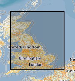
This dataset contains dissolved methane concentrations from groundwater in Great Britain, predominantly from England. Data were collated in Microsoft Excel (.xlsx) format from four publicly accessible sources: the British Geological Survey (from Bell et al., 2017), the Environment Agency for England (from the online Water Quality Archive), and local baseline data for the shale gas sites of Preston New Road (from Cuadrilla Resources) and Kirby Misperton (from Third Energy). In total, 2997 dissolved methane concentrations are included in the dataset and were collected from 922 unique locations from October 1992 to July 2018. The data were used within a Bayesian framework to create a dynamic baseline (a baseline that can change in time and space to reflect ongoing environmental change) that can predict the probability that a change in dissolved methane concentration has occurred, for example in the context of monitoring aquifers at shale gas sites using hydraulic fracturing methods. The data presented are the underlying dataset to Wilson et al., 2020, Science of the Total Environment: https://doi.org/10.1016/j.scitotenv.2019.134854. Bell, R. A., Darling, W. G., Ward, R. S., Basava-Reddi, L., Halwa, L., Manamsa, K., & Dochartaigh, B. Ó. (2017). A baseline survey of dissolved methane in aquifers of Great Britain. Science of the Total Environment, 601, 1803-1813. Wilson, M. P., Worrall, F., Davies, R. J., & Hart, A. (2020). A dynamic baseline for dissolved methane in English groundwater. Science of The Total Environment, 711, 134854.
-

NIGL (NERC Isotope Geosciences Laboratories) is a comprehensive stable and radiogenic isotope laboratory facility that undertakes environmental, life, archaeological and earth science research, and educates and trains PhD students, in a collaborative research environment. This dataset contains a complete listing of projects undertaken by NIGL since its formation in 1987. It includes projects approved by the NERC Isotope Geoscience Facilities Steering Committee, projects with BGS, BAS and other NERC institutes, and commercial work.
-

NIGL (NERC Isotope Geosciences Laboratories) is a comprehensive stable and radiogenic isotope laboratory facility that undertakes environmental, life, archaeological and earth science research, and educates and trains PhD students, in a collaborative research environment. This dataset contains a complete record of publications and scientific reports involving NIGL staff, dating from the formation of the group in 1987. The published research is not geographically restricted.
-

NIGL (NERC Isotope Geosciences Laboratories) is a comprehensive stable and radiogenic isotope laboratory facility that undertakes environmental, life, archaeological and earth science research, and educates and trains PhD students, in a collaborative research environment. This dataset contains project records undertaken by NIGL since its formation in 1987. It includes projects approved by the NERC Isotope Geoscience Facilities Steering Committee, projects with BGS, BAS and other NERC institutes, and commercial work.
-

The UK Geoenergy Observatories (UKGEOS) Glasgow facility, baseline soil geochemistry dataset released from the BGS comprises an excel file with two spreadsheets. The first spreadsheet contains information on the chemical composition of 90 topsoil (0 - 20 cm) samples collected from seven initially proposed borehole sites for the UKGEOS Glasgow facility, and from two control sites, in February-March 2018 (03-18). Ten samples were collected from each site prior to installation of the UKGEOS Glasgow facility, and underwent laboratory analysis. Chemical data for pH and the total concentrations of 54 inorganic and 75 organic substances in the soil samples are presented. In addition, the dataset contains locational and descriptive information about the samples noted during sampling. The analyte name, element chemical symbols, analytical method, units of measurement and limits of quantification are recorded in header rows at the top of the spreadsheet. The dataset includes qualifiers, highlighting any quality control issues reported with the data. The data qualifiers are explained in the second spreadsheet released with the data. Further details about the dataset can be found in the accompanying report http://nora.nerc.ac.uk/id/eprint/527798/.
-

The UK Geoenergy Observatories (UKGEOS) Glasgow baseline surface water chemistry dataset1 released from the BGS comprises an excel file with two spreadsheets. The first spreadsheet contains information on the chemical composition of 98 surface water samples (84 samples and 14 field duplicates) collected monthly for 14 months between February 2019 and March 2020 from six sampling locations. These comprised three on the River Clyde at the UKGEOS Glasgow Cuningar Loop borehole cluster and three from control sites (two on the River Clyde and one on the Tollcross Burn). Field measurements of pH, redox potential, specific electrical conductance, temperature, dissolved oxygen and alkalinity and laboratory chemical data for concentrations of 71 inorganic and 10 organic substances in the surface water samples are presented. The dataset contains locational and descriptive information about the samples also. The analyte name, element chemical symbols, analytical method, units of measurement and long-term limits of detection are recorded in header rows at the top of the spreadsheet. The limits of detection/quantification for each monthly batch of samples are documented in rows at the head of each batch. The dataset includes abbreviations documenting quality control issues such as missing values. A guide to abbreviations used in the dataset is provided in the second excel spreadsheet released with the data. Further details about the dataset can be found in the accompanying report http://nora.nerc.ac.uk/id/eprint/529818.
 NERC Data Catalogue Service